To understand the Kokoda campaign, you have to understand what the Japanese high command wanted from it — and why a single mountain track became worth fighting for. In 1942 the Kokoda Track was the most direct route to Port Moresby, the last Allied base between Japan's southward advance and the Australian mainland. This is the story of why that mattered, and how a 96-kilometre footpad through the Owen Stanley Range became the place Japan's Pacific momentum finally broke.
The prize: Port Moresby
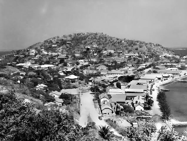
After Pearl Harbor, Japan swept south. Rabaul fell in January 1942, giving Japan a forward base in the Australian mandate territory of New Guinea. The next objective was Port Moresby — its deep harbour and airfields made it a vital strategic target. With Port Moresby in Japanese hands, aircraft could strike northern Australia and disrupt Allied supply lines across the Pacific.
For the Japanese high command, capturing Port Moresby was also the key to isolating Australia. Control of Papua New Guinea would sever the Allied naval movements that kept American reinforcements reaching the Australian mainland. Port Moresby was not just a base — it was the hinge of the whole southwestern Pacific position.
Two attempts at sea
Japan first tried to take Port Moresby from the water. The Battle of the Coral Sea in May 1942 turned that attempt back, and the carrier force that might have supported a second push was shattered at Midway the following month. Denied the sea route, the Japanese chose the only route left: overland, across the Owen Stanley Range from beachheads established at Gona, Buna and Sanananda on the north coast.
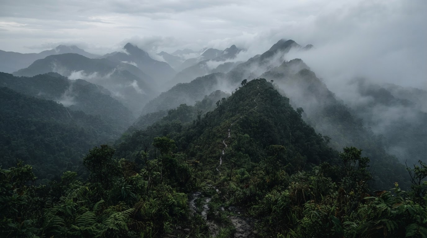
It was a decision born of strategic necessity. The Kokoda Track — narrow, steep, climbing to over 2,000 metres — was the only viable land route through the range. What had been a local footpath became a wartime highway for an army, and the focus of the entire campaign.
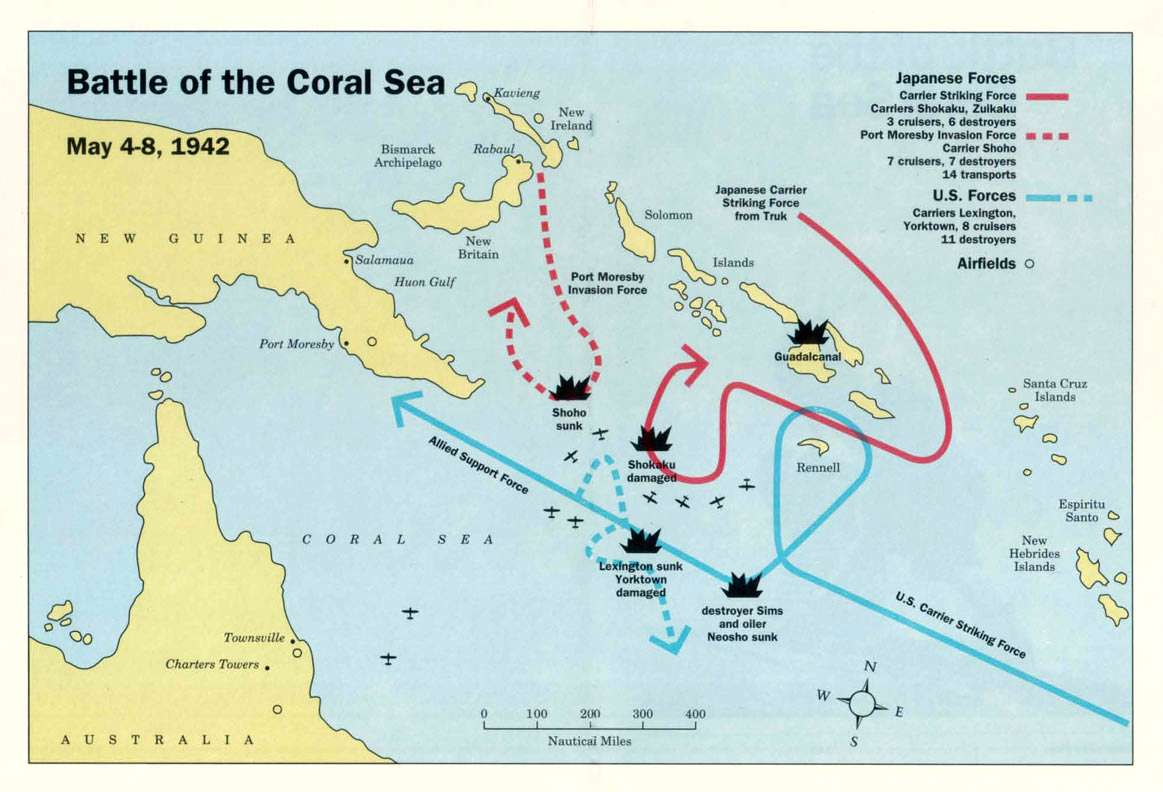
Denied the sea route, Japan chose the only route left — overland, across the Owen Stanleys — and a 96-kilometre footpad became the place its Pacific momentum broke.
The South Seas Detachment
Major General Tomitarō Horii's South Seas Detachment landed on the north coast in July 1942 — about 6,000 troops, experienced jungle fighters carrying light equipment suited to mountain warfare. They moved swiftly inland, forcing local populations to flee or submit, and pushed south toward the range.
The strategic logic was simple and brutal: drive over the Owen Stanleys, take Port Moresby from the landward side, and cut Australia off from its allies. What the plan did not account for was the terrain — and the Australians waiting on the other side of it.
The militia that held the line
The force first sent to meet the Japanese advance was not the celebrated veterans of the Middle East but the 39th Battalion — Australian Militia, part-time soldiers, many barely trained and some still in their teens. Ordered into the jungle in mid-1942, they reached the plateau village of Kokoda that gave the Track its name and held it against the advancing Japanese.
Outnumbered and supplied only by what could be carried on men's backs, they fought, fell back, re-formed, and fought again — a fighting withdrawal through the range that bought Australia the time it needed. Theirs is the quietly astonishing story of a handful of young men who held a line long enough for help to arrive.
Isurava — the turning point
By August the 39th was reinforced by battle-hardened AIF battalions recalled from North Africa — the 2/14th, 2/16th and later the 2/27th — rushed to New Guinea. At Isurava, in a four-day battle of close-quarters fighting in harsh mountain conditions, the Australians made their defining stand.
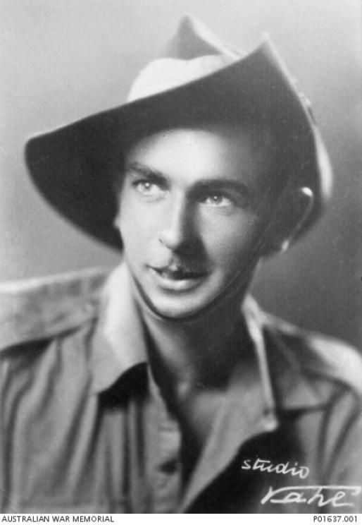
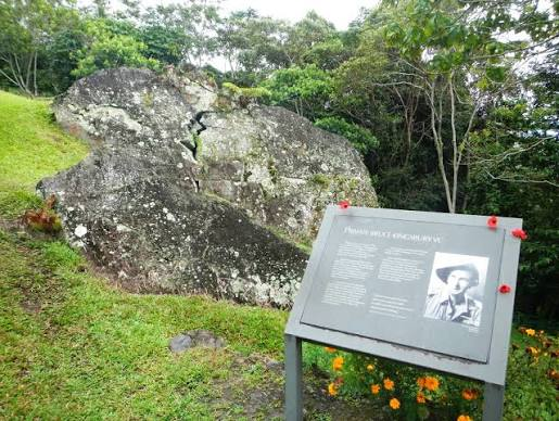
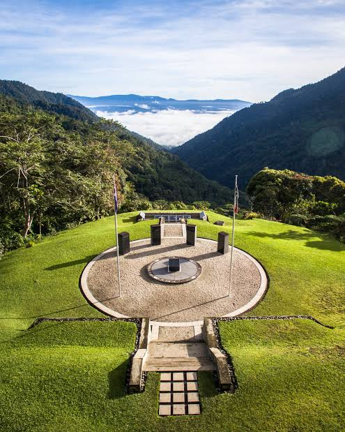
Private Bruce Kingsbury of the 2/14th Battalion won a posthumous Victoria Cross for his counter-attack with a Bren gun, driving back a Japanese advance before being fatally wounded. The position could not be held, but the stand cost the Japanese the momentum they never fully regained — and began the long fighting withdrawal south through Brigade Hill and Mission Ridge.
The high-water mark at Ioribaiwa
By mid-September the Australians had been pushed back to Imita Ridge — the last defensible position before Port Moresby. The Japanese reached Ioribaiwa, within sight, some say, of the lights of the city. But they were spent. A single foot track through the mountains was their only supply line, and disease, starvation and the Australians' stubborn rearguard had hollowed them out.
At Milne Bay, on the eastern tip of the peninsula, an Australian force had already inflicted Japan's first land defeat of the war. Facing the impossible logistics of supplying a forward battle across the range, the Japanese were ordered to withdraw — and the tide of the Pacific war turned with them.
The ground that decided it
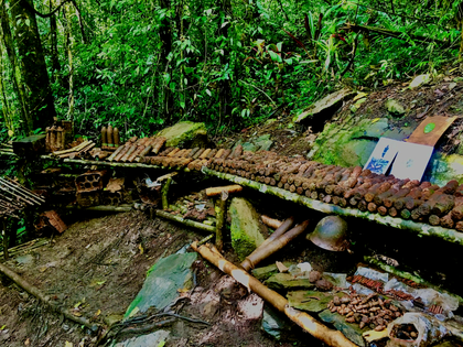
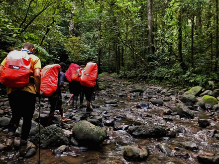
The Owen Stanley Range rises above 7,000 feet, with near-vertical climbs, deep valleys and visibility often under 100 feet in fog and rainforest canopy. No vehicles could reach the front — every shell, ration and round of ammunition was carried on a man's back up punishing inclines that turned to mud in the tropical downpours.
Disease took a toll that dwarfed the bullets. Malaria, dysentery and scrub typhus infected soldiers on both sides; wet conditions rusted weapons and spoiled ammunition. The terrain that made the Track such a difficult route for an army was the same terrain that bled the Japanese advance to a halt — and made the Australian fighting withdrawal possible.
The carriers and the cost
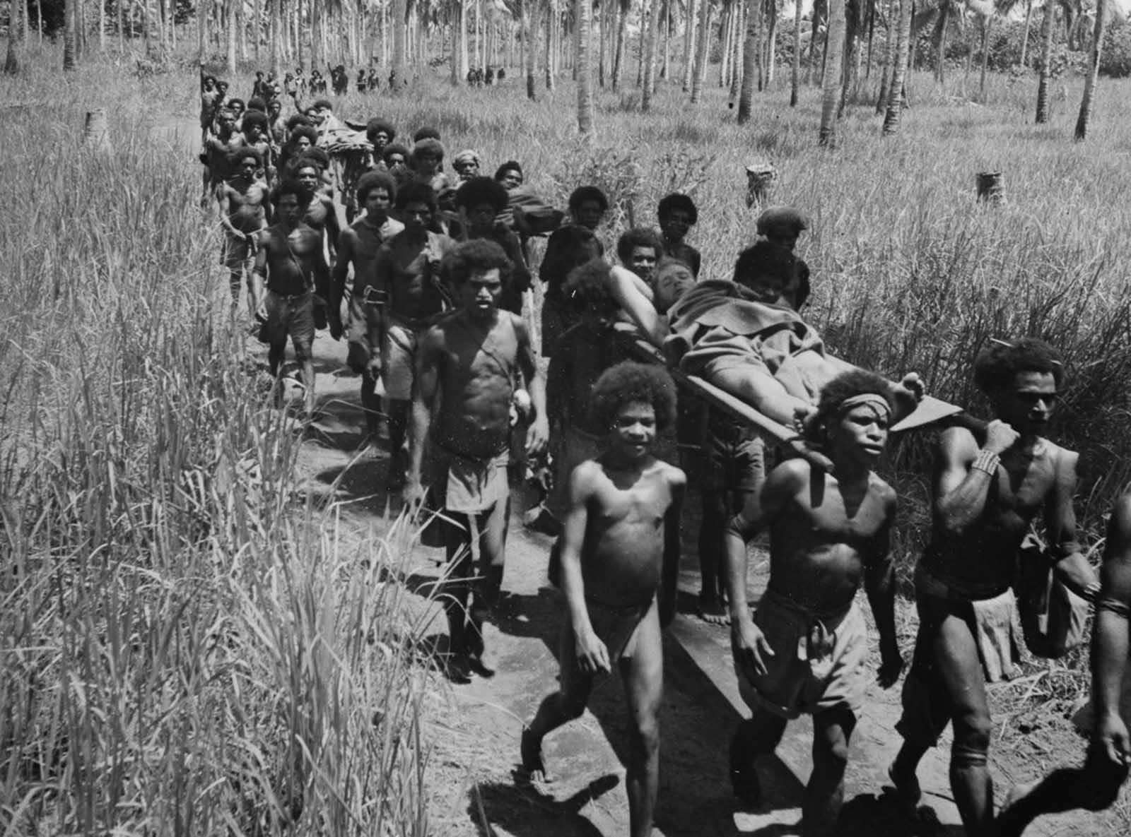
Both armies relied on local Papuan carriers to move supplies through the mountains. The men who ferried stores up the range and carried Australia's wounded down — often on stretchers fashioned from saplings — became known as the Fuzzy Wuzzy Angels. Their care for the injured, across language and culture, became one of the campaign's most enduring legacies, and their descendants still live in the villages along the Track today.
The campaign claimed roughly 600 Australian and some 3,000 Japanese lives, with far more lost to disease and starvation than to combat. Japanese losses at Isurava alone — about 550 killed and 1,000 wounded — crippled the offensive capacity that had carried them so far. War photographer Damien Parer's images brought the campaign into Australian homes and fixed Kokoda in the national memory.
Walking it today
Kokoda saved Port Moresby and, with it, Australia's strategic position in the Pacific. The campaign exposed the weakness in Japan's plan — overextended supply lines through impossible terrain — and proved that ground could negate numerical superiority. It was the turning point from which Japan's Pacific advance never recovered.
To walk the Kokoda Track now is to read that story in the ground itself: the ridges they climbed, the creeks they drank from, the villages where the campaign turned. It is not a museum behind glass. It is a living Track — and the strategic story that made it matter is still written into every kilometre.
Get the full Kokoda Training & Packing Guide
The 12-week training plan, full packing list, and what to expect on the 96km Track — from our 20-year guides, straight to your inbox.
Australian Chaperone & Track Historian
Darcy — Chaperone
Darcy has walked the Kokoda Track for more than a decade as an Australian Chaperone, studying the 1942 campaign from both sides of the line and the families along the Track.